Reiteration: The Hidden Treasure Problem - if you have hundreds of placemarks (or other features) making up a large data set in a Google Earth project its a problem to render (get your PC to draw) them on screen without overloading the graphics card. The regions feature allows you to set a box in space - if the user's viewpoint is within this box the placemarks plot, if they aren't, the placemarks are hidden. If you split your placemarks into lots of these boxes, then you only see placemarks in your area and you get around the large data set problem. All very good. Problem is people are using the regions function without giving users a signal that there is hidden data within the boxes, so you could fly too high to see placemarks and not realize anything was there at all. I suggested an overlay of a magnifying glass icon was a solution.
In a video from the Google I/O conference, Bent Hagemark refers to regions (14 minutes in)
you might like to watch it with the slides in better resolution here
He notes the hidden treasure problem and suggests marking the position of hidden data with a placemark. I suspect my overlay idea is better but lets not quibble. He also describes how to arrange a series of ground overlays so that when you fly in Google Earth increases the resolution. This is done using regions, low res large area images render at altitude and Google Earth shows high res small area images only when you fly low. This is a great idea which doesn't suffer from the hidden treasure problem. There are three applications of this idea which spring to mind:
- In an emergency situation (say for the Chinese earthquake) NGOs want to view satellite data of the area they are working in but often have only intermittent connection to the web. You could send them a USB key with a KMZ file containing satellite imagery organized by regions*. There is no need for GE to be online and you could also provide updates not available in Google Earth itself - e.g. up to date imagery after a Tsunami strike showing which roads and bridges have been destroyed.
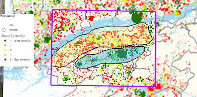
- If you have a wide coverage of thematic maps you could arrange the maps in regions so that the user sees higher resolution thematic maps as they fly in. To illustrate the image below is from an earlier post, it shows two thematic maps: one large low res and one small high res image. By using regions you could get the large map to render whilst the view is at altitude but as they fly in a series of the smaller maps appear.

- Picture Frames that only appear depending on your altitude. E.g. details of how to negotiate road blockages after a Tsunami in placemarks ('The bridge here is down but the river can be forded up river 2km, I've drawn a path to show you the route', ). You wouldn't want to see all the details in a high altitude view but by 'flying' your planned route at low level you could plan how you were going to do it.
*Interestingly, this is actually how the base data in Google Earth itself is organized.
No comments:
Post a Comment